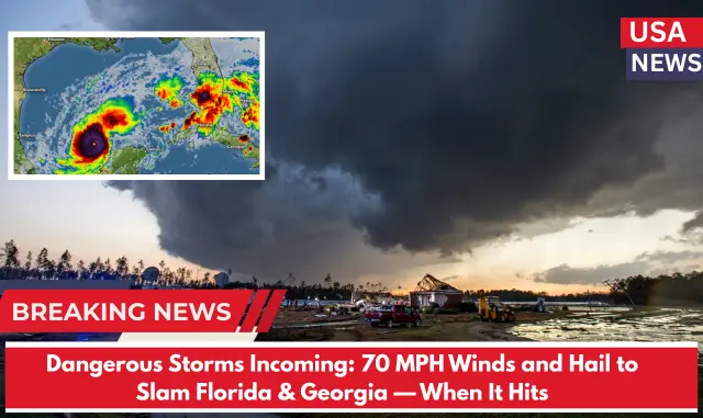
⚠️ Intense Rain Triggers Flash Flood Warning in Florida & Georgia
At 11:32 a.m., the National Weather Service (NWS) in Jacksonville issued a Flash Flood Warning after Doppler radar detected extremely heavy rainfall, with rates ranging from 2 to 4 inches per hour. Some areas have already recorded over an inch of rain, raising serious flood concerns.
“Flash flooding caused by thunderstorms,” the NWS warned. “Flash flooding is ongoing or expected to begin shortly.”
Warning in Effect Until 3:30 p.m.
⚠️ Affected Counties:
Florida:
- Duval
- Nassau
- Clay
Georgia:
- Camden
- Charlton
- Glynn
Flooding is expected to impact creeks, streams, city streets, highways, underpasses, and other low-lying areas prone to water accumulation.
Cities At Risk:
- Jacksonville, FL
- St. Marys, GA
- Kingsland, GA
- Brunswick, GA
- Orange Park, FL
NWS Urges Caution:
“Turn around, don’t drown when encountering flooded roads. Most flood-related fatalities happen in vehicles.”
Additional Weather Alerts:
A Severe Thunderstorm Watch remains in effect until 5:00 p.m. Friday across much of northern Florida and southern Georgia, including counties such as Clay, Baker, Nassau, Camden, and Glynn. Residents should stay alert for rapidly changing weather conditions.
More Storms Are Expected:
The National Weather Service reports that more heavy storms will continue to move through the area this afternoon, increasing the risk of localized flooding and hazardous driving conditions.


