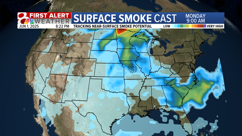
Hazy sky lingers:
We expect wildfire smoke to linger in the region until Monday night, when moisture is expected to arrive. We do not expect any significant air quality issues, but more sensitive groups may want to limit their time outside.
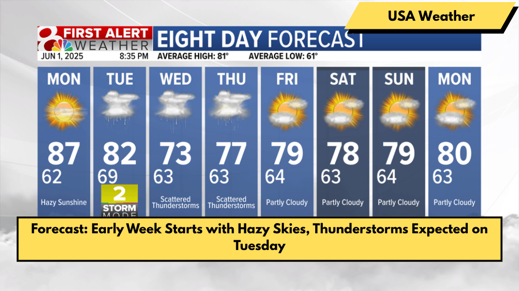
Active week ahead:
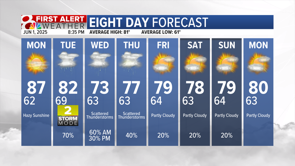
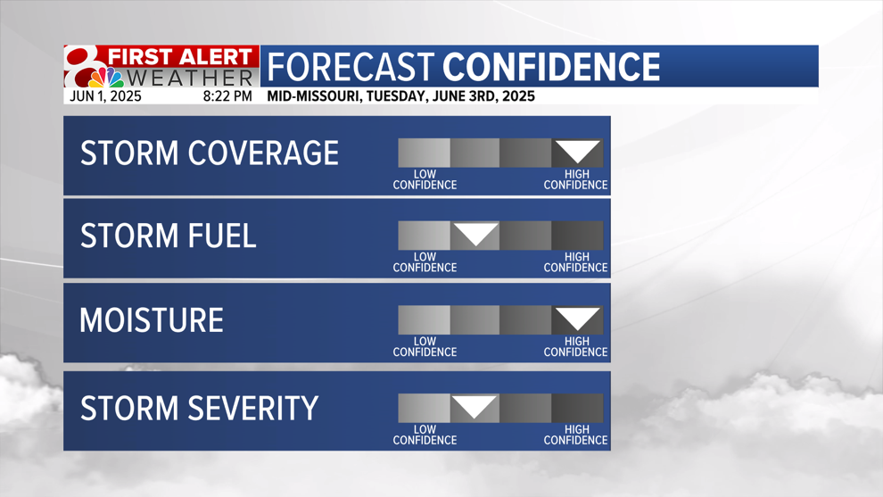
A Storm Mode Index of 2 is in effect for Tuesday, which means there could be problems and you should stay informed.
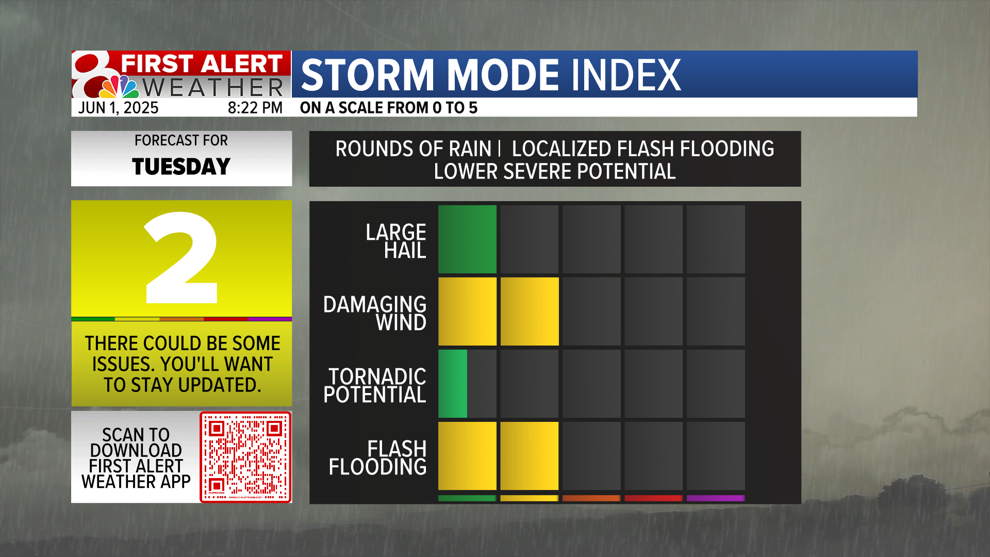
We are tracking a wave of atmospheric energy that we anticipate will bring abundant moisture and widespread thunderstorms. The main thing we’re still waiting for are the fine details. How much storm fuel will we have? Will there be enough rain for significant flooding? We’ll learn a lot more tomorrow once we get high-resolution guidance and can see how much moisture is entering the viewing area.
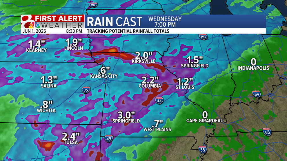
Regardless of Tuesday’s outcome, we expect most of the viewing area to receive 2 inches or more of rain by the end of Wednesday. Local areas could see up to 4″ by this time; we’ll have more details as we get closer.
This active pattern could linger for a while yet, perhaps even well into next week.