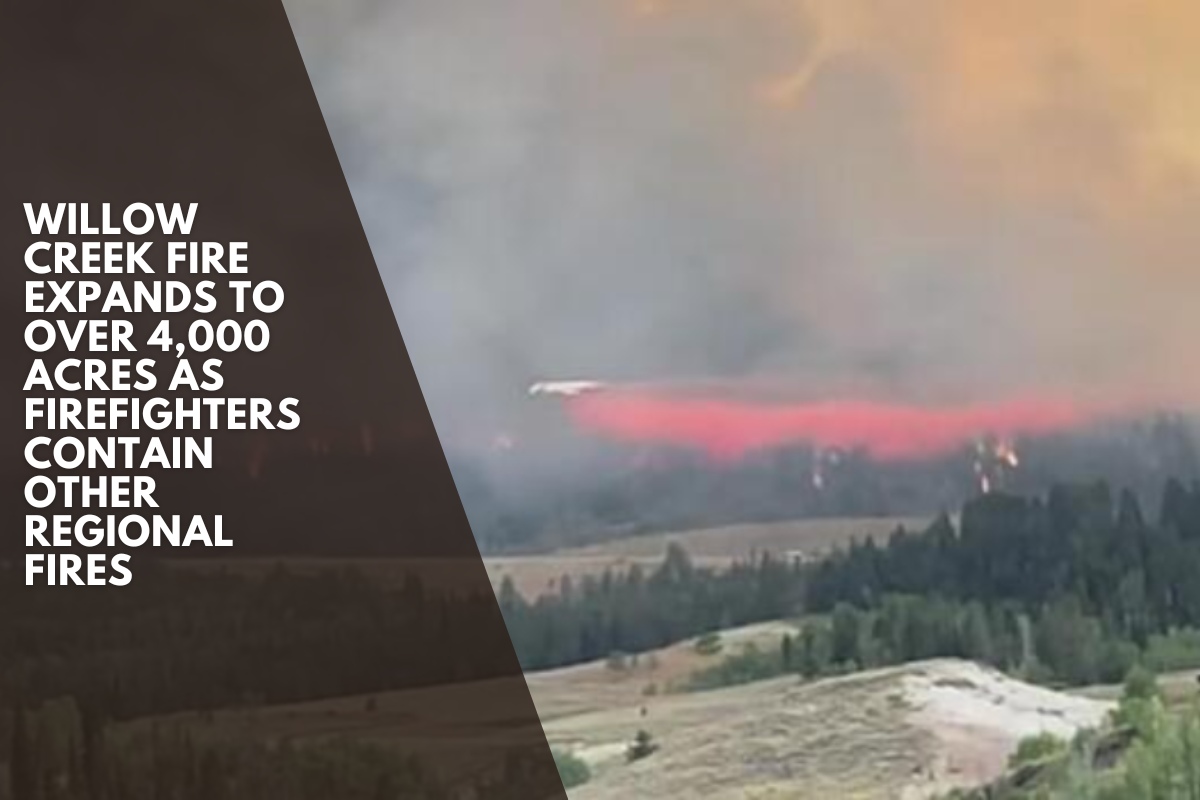
The Willow Creek Fire near the Idaho-Wyoming border remains the dominant wildfire in the region, spanning 4,065 acres with 28 percent containment as of Sunday, while several smaller fires in East Idaho have reached full containment following recent rainfall, according to the US Forest Service.
The Willow Creek Fire, which began on August 22, has 370 personnel assigned and is still active, with officials predicting increased fire behavior as warmer, drier weather arrives this week. The fire is located south of Smoot, Wyoming, approximately 35 miles southeast of Soda Springs.
According to the Forest Service, firefighters continue to use the 381 Road to access the interior and western perimeter of the fire in order to extinguish hot spots.
Crews are working to improve and extend existing containment lines. Helicopters are assisting firefighters with water drops along the northern perimeter and delivering supplies to crews in remote camps.
Crews on the east side of the fire are expanding their structural assessments east of Highway 89. Additional personnel are arriving to assist and relieve crews who will be returning home for a rest.
The National Weather Service predicts that temperatures will rise this week, while humidity will fall slightly.
Lincoln County, Wyoming, uses the READY, SET, GO! method to keep evacuation zones in the “SET” status. The zones run from milepost 75 south (near Gomm’s Pond Lane) to Salt Pass, and west of Highway 89 from Reeves-Schwab Lane to Gomm’s Pond.
Residents should be prepared for an evacuation if a “GO” order is issued. Lincoln County Homeland Security & Emergency Management will initiate code red notifications.
A forest closure remains in effect for parts of the Bridger-Teton National Forest’s Grey River and Kemmerer districts.
The closure boundary extends from Highway 89 west along the Bridger-Teton National Forest boundary to the Wyoming-Idaho state line, north along the state line to the forest-private boundary, and southeast back to Highway 89. Both the Allred Flat Campground and the Smiths Fork Winter Trailhead are closed.
The fire initially forced the closure of Highway 89, but the road is now open. Still, travelers on the highway should proceed with caution due to the presence of fire vehicles and equipment in the area, and they should not stop or park along the roadside to view the fire, officials said.
Meanwhile, heavy rains last week helped firefighters put out several fires in the Caribou-Targhee National Forest in East Idaho, according to forest officials.
The 27-acre Rim Trail Fire, located 13 miles northeast of Tetonia, has been completely contained, according to the Forest Service. Forest roads and trails that had been closed, including Forest Roads 658, 809, and 813, and Forest Trails 002, 010, 013, and 015, reopened Friday night.
The 19-acre Toponce Fire, located 9 miles northeast of Inkom, was also completely contained, as was the small Chicken Fire east of Swan Valley, which burned only one-tenth of an acre near Upper Palisades Lake.
The 3.2-acre Rocky Top Fire, located 11 miles northwest of Swan Valley, is still smoldering in steep, rocky terrain but is no longer considered a threat by authorities.
Lightning started all four Caribou-Targhee fires, but the Willow Creek Fire’s cause is still unknown.
There have been no reports of injuries or structural damage from the blazes.