KANSAS CITY, Missouri — The cold front that caused our severe weather is now south of those counties. A severe storm pounded parts of Henry County, including La Due, with hail nearly baseball-sized. At 2:45pm, there was no storm. By 3:18pm, it had quickly developed into a severe thunderstorm in just 33 minutes!
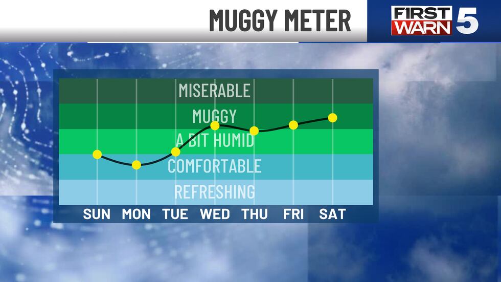
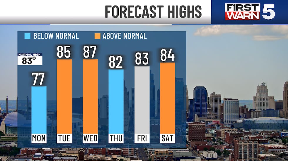
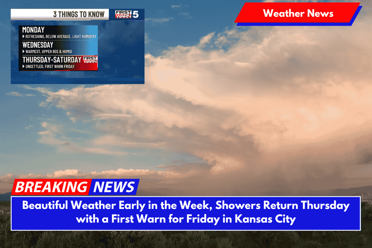
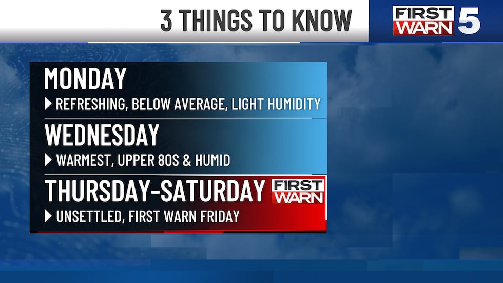
Moving forward, the cold front is refreshing our air. Monday looks great, with below-average temperatures and humidity. This week’s coolest day included some free air conditioning. Tuesday looks good as well. Humidity remains low, while high temperatures return to average, in the middle 80s.
Warm, muggy air returns from the south Wednesday. You’ll notice a difference, especially with temperatures in the upper 80s. A series of storms feed off of this more energetic air, keeping things unsettled on Thursday, Friday, and Saturday.
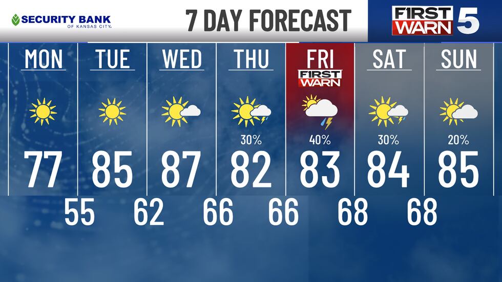
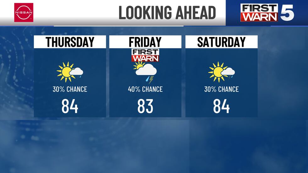
Expect several rounds of showers and thunderstorms. Good news: no signs of severe weather. A First Warning for Friday remains in effect for our most powerful and impactful storms. Sunday brings in drier air.
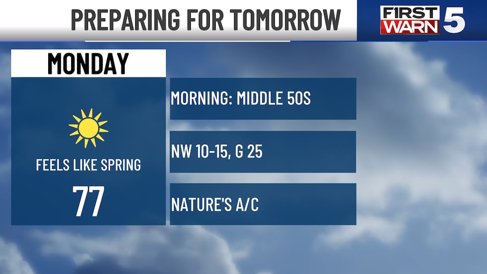
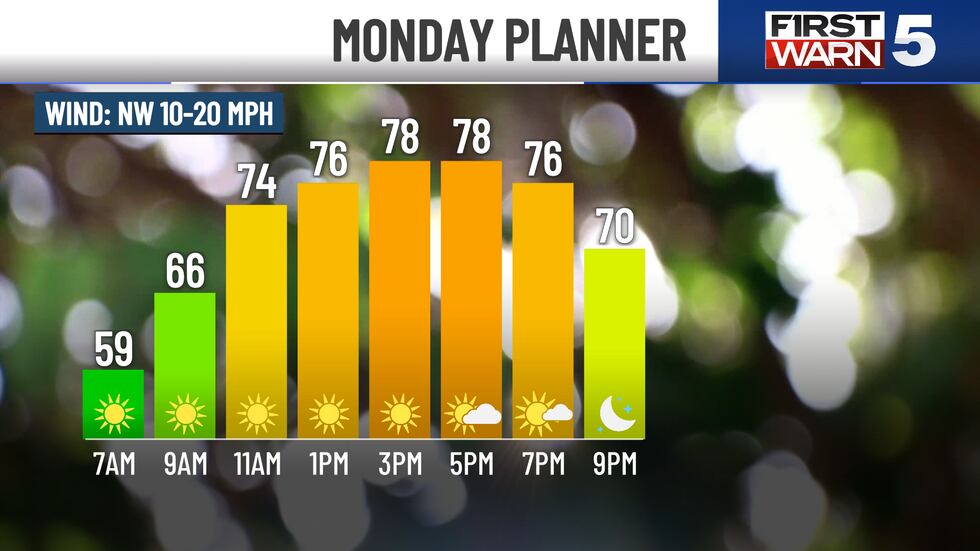
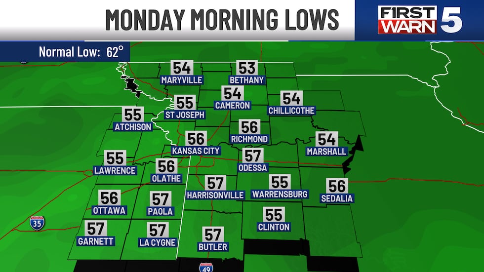
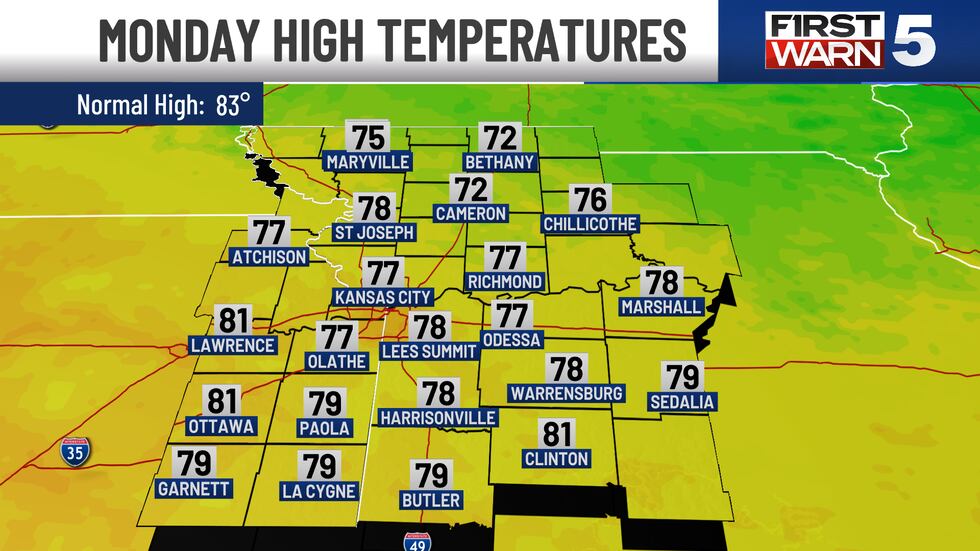
MONDAY: Sunny and comfortable. Lows in the middle 50s, highs in the middle 70s. A little breezy, though, NW 10-15 mph with gusts to 25 mph.
TUESDAY: Sunny and warm, with humidity remaining in the comfortable range. Lows are in the upper 50s, and highs reach the mid-80s.
WEDNESDAY: Warm and sticky, with increasing clouds and southerly winds of 10-20 mph. Our mostly sunny morning transitions into a partly cloudy afternoon.
THURSDAY, FRIDAY, AND SATURDAY: Unsettled weather with a 30% chance of showers and storms. Thursday, 40% Friday, 30% Saturday. These aren’t lost days. There’s plenty of dry time to spend outside. Lows only drop into the upper 60s, while highs rise into the mid-80s.