⚠️ Intense Rain Triggers Flash Flood Warning in Texas & Oklahoma
At 11:32 a.m., the National Weather Service (NWS) in Dallas issued a Flash Flood Warning after Doppler radar detected extremely heavy rainfall, with rates soaring between 2 to 4 inches per hour. Some areas have already received over an inch of rain, raising urgent concerns for residents.
“Flash flooding caused by thunderstorms,” the NWS confirmed. “Flash flooding is ongoing or expected to begin shortly.”
Flash Flood Warning in Effect Until 3:30 p.m.
⚠️ Counties Under Alert:
Texas:
- Dallas
- Tarrant
- Denton
Oklahoma:
- Tulsa
- Oklahoma County
- Wagoner
Flash flooding is expected to impact creeks, streams, city streets, highways, underpasses, and other low-lying flood-prone areas.
Cities Most at Risk:
Dallas, Fort Worth, Arlington, Tulsa, Norman, Edmond, and surrounding communities.
NWS Safety Reminder:
“Turn around, don’t drown.” Avoid driving through flooded roads — most flood-related deaths happen in vehicles caught in high water.
Additional Weather Alerts:
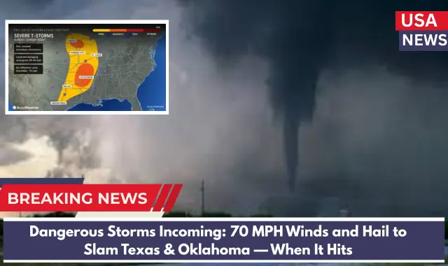
A Severe Thunderstorm Watch remains active until 5:00 p.m. today for much of central and northern Texas and parts of Oklahoma, including Dallas, Tarrant, Denton, Collin, Grayson, Tulsa, and surrounding counties. Residents should stay alert for damaging winds, hail, and more heavy rain.
More Storms on the Horizon:
The National Weather Service warns that additional severe storms are expected later today, bringing strong winds, hail, and further heavy rainfall. Stay tuned to weather updates and follow safety instructions from local authorities.
By staying informed and cautious, you can protect yourself and your loved ones during this dangerous weather event.


