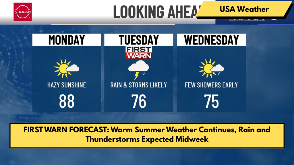
KANSAS CITY, Mo. – We carry a taste of summer from the weekend into the new work week, but rain and thunderstorms will soon return.
The overnight lows briefly dip into the lower 60s under mostly clear skies. There were indications that the Northern Lights could be visible into Sunday night, and while there is still a chance, the geomagnetic storm interacted with Earth earlier than anticipated. The latest trends do not bode well for Kansas and Missouri.
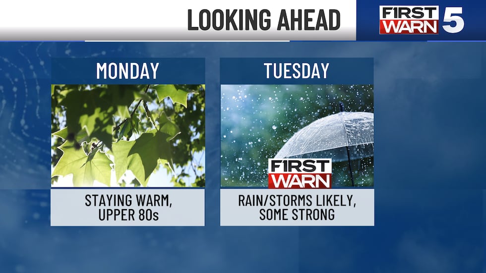
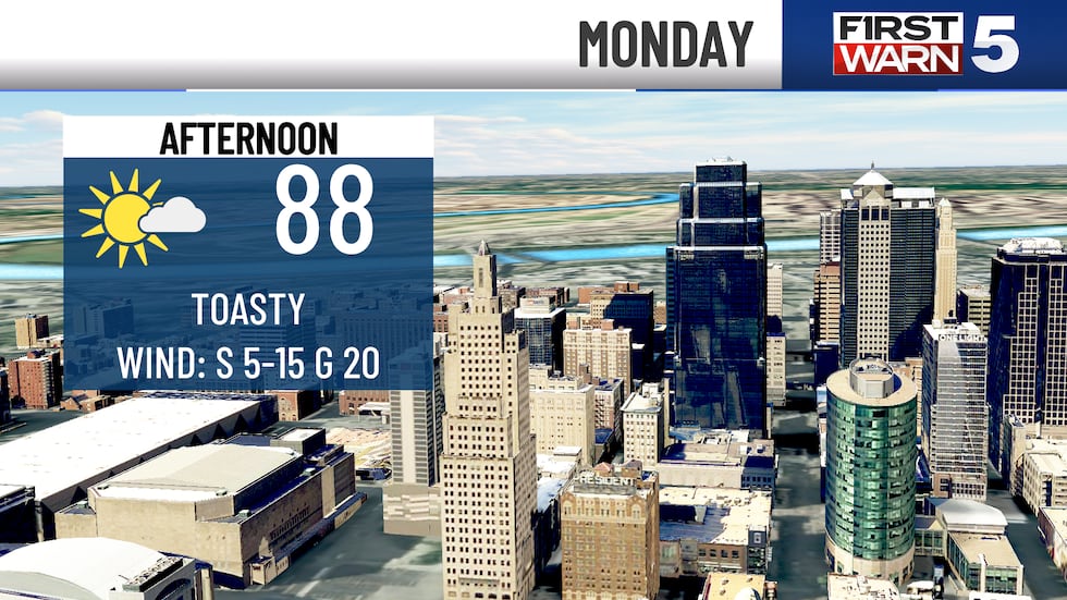
Monday looks just as warm as the weekend. As the sun shines brightly, temperatures in the lower 60s quickly rise. We can expect temperatures in the upper 80s throughout the afternoon. Wildfire smoke from Canada contributes to a hazy sky during the day, but air quality should not worsen significantly.
Monday is dry, but from Monday night to Tuesday morning, our pattern becomes much wetter.
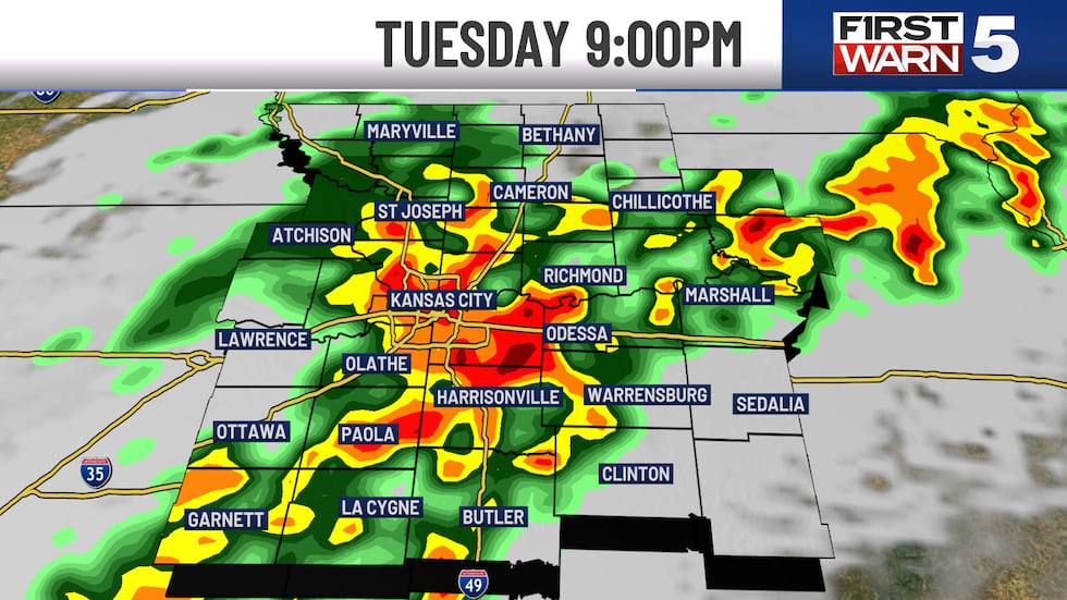
Our next First Warn is scheduled for Tuesday. Rain and thunderstorms are likely throughout the day. While it won’t be every minute of Tuesday, multiple batches are expected to track through the region.
A few storms may be strong in the morning and again later in the evening. Those of you along and east of I-35 are currently at a level 2/5 risk of severe weather.
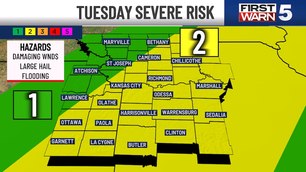
Gusty winds and hail are the current concerns. The tornado threat is reduced. With multiple batches of rain and thunderstorms, there is a chance of receiving at least an inch of rain by Tuesday night, with some data indicating up to three inches in some areas.
My attention is drawn to the thunderstorms that will form later in the evening as a cold front approaches. That front should pass through early Wednesday morning, drying us out for the rest of the day before cooling us back down.
Our weather pattern has become somewhat unsettled as the week comes to an end. Several different systems pass through the region, providing us with random showers here and there.
We will maintain a 30% confidence on Thursday and Friday. Temperatures appear to be much less hot, with many days in the 70s and low 80s.


