A wet weather pattern is moving across the country and will bring steady rain to Minnesota on Monday and Tuesday.
The National Weather Service says, “Showers will start Monday and continue into Tuesday, with the heaviest rain expected in southern Minnesota. There might be a few thunderstorms, but no severe weather is anticipated.”
The best chance for heavy rain will be in western and southern parts of the state, especially near the Interstate 90 corridor. Areas north of Interstate 94 will likely see less rain.

Rain is expected to begin Monday morning in southwestern Minnesota, while the Twin Cities should stay mostly dry until later in the day. Rainfall will increase throughout Monday and is expected to continue through Tuesday night.

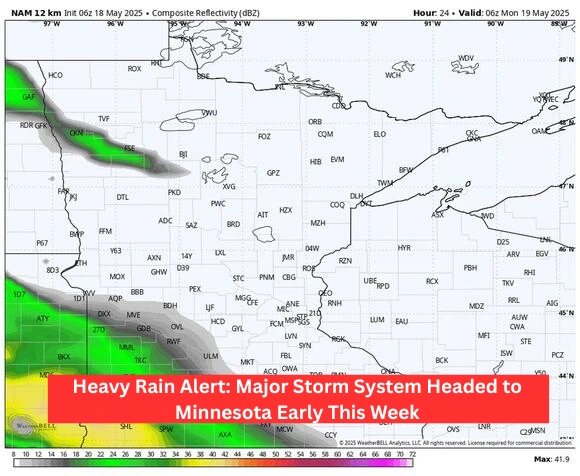
The National Blend of Models (NBM) predicts the highest rainfall — between 1.5 to 2 inches — in far southern Minnesota. Meanwhile, the European weather model suggests even heavier rain, forecasting 2 to 4+ inches across a large area including the Twin Cities, Mankato, and Rochester. The NAM model is starting to align with the European forecast.

In contrast, the Canadian model keeps the Twin Cities mostly dry.

So, while there’s some variation between forecasts, prepare for a good chance of rain early this week, especially in southern Minnesota.