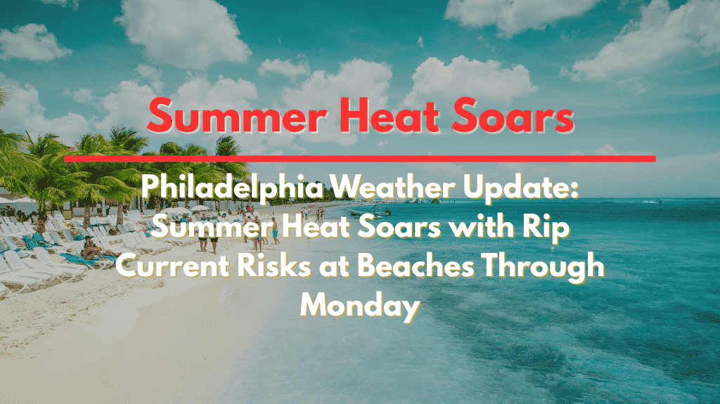
A surge of summer heat is gripping the Delaware Valley, pushing temperatures into the upper 80s and creating a persistent risk for dangerous rip currents at area beaches. Philadelphia, Trenton, and much of South Jersey are expected to experience above-normal temperatures over the weekend and into early next week, with the hottest day forecasted for Monday, July 31st.
🌞 Rising Heat: What to Expect This Weekend
According to the National Weather Service in Mount Holly, high-pressure systems will keep the region warmer than usual through Monday. On Sunday, highs will reach around 85°F in inland cities like Allentown and Trenton, with lower 80s along the coast. By Monday, the heat intensifies, with Philadelphia, Reading, and Vineland expected to hit 88-89°F and Atlantic City reaching the mid-80s.
Beaches like Cape May and Bethany Beach will remain slightly cooler, but the rip current risk will remain high throughout the weekend.
🌊 Rip Current Risks: Stay Safe at the Shore
While the beaches will offer some relief from the heat, rip currents are expected to be dangerous for swimmers and surfers. The National Weather Service urges anyone heading to the shore to stay near lifeguards, avoid venturing into rough surf, and exercise caution. Rip currents can be difficult to detect and swiftly pull swimmers away from shore.
For those planning to swim or surf, it’s important to check local beach conditions before entering the water and follow all safety warnings from lifeguards.
💧 Health and Utility Impacts
With the heat comes added strain on utilities, as air conditioners will be working overtime, and residents will need to stay hydrated to avoid heat-related illnesses. Vulnerable populations, including elderly individuals and those with pre-existing health conditions, should take extra care, especially during the peak afternoon heat.
The heat will also affect outdoor activities—residents are urged to limit strenuous exercise and avoid excessive time in direct sunlight, particularly during the hottest part of the day between noon and 4 p.m.
🌤️ Looking Ahead: A Hot Week Continues
The high-pressure system responsible for the heat will linger through Tuesday, August 1st, keeping temperatures above average. Some slight relief is expected midweek, but highs will remain in the 80s through the week. Additional weather advisories could be issued if the conditions change or worsen, so keep an eye on local forecasts.
🌞 Five-Day Forecast for Philadelphia and the Surrounding Area
Sunday, July 30:
High: 82°F (coastal areas) – 85°F (inland)
Chance of rip currents at the beaches
Warm, sunny day
Monday, July 31:
High: 88-89°F in Philadelphia, Reading, and Vineland
Rip currents continue at beaches
Sunshine and high heat
Tuesday, August 1:
High: 85-88°F
Slight cooling expected by midweek
Increased chance of afternoon clouds and light breezes
Wednesday, August 2:
High: 84-87°F
Chance of afternoon showers or storms
Less humidity than earlier in the week
Thursday, August 3:
High: 85°F
Mostly sunny, with continued mild heat
Slight chance of storms in the evening
📝 Final Thoughts
Philadelphia and much of the Delaware Valley are set to experience high heat and humidity through Monday, July 31st. While the heat is expected to ease slightly midweek, rip currents at area beaches remain a serious risk for those headed to the shore. Stay cool, stay hydrated, and exercise caution if you’re spending time outdoors or at the beach.


