Warm and Hazy Today
Today was warm with plenty of sunshine, but some haze appeared due to smoke from wildfires in Canada. Winds blew from the south at 5 to 15 mph.
Tonight and Tomorrow’s Temperatures
Tonight will stay mild with lows in the low 60s. Tomorrow, it will get warmer with highs reaching the low 90s in most areas and upper 80s elsewhere.
Storms Expected Tomorrow Evening
A cold front will move across Nebraska tomorrow evening, bringing thunderstorms. Storms will form from north central to western Nebraska, then move southeast through the night.
Severe Weather Risks
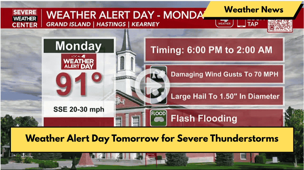
- A Weather Alert Day is in effect from 5 PM for North Platte and from 6 PM to 2 AM for the Tri-Cities.
- The Storm Prediction Center has issued a slight risk for much of western and central Nebraska, and a marginal risk for the rest.
- Main dangers include strong wind gusts up to 70 mph and large hail (up to golf ball size).
- Tornado chances are low but not impossible, especially in western Nebraska.
Heavy Rain and Flooding Possible
Storms could bring heavy rain overnight, with some areas getting 2 to 4 inches of rain, causing isolated flash flooding. Most places will see 1 to 2 inches.
Rain and Cooler Temperatures Tuesday
More light to moderate rain is expected Tuesday afternoon, becoming fewer by evening. Temperatures will cool to the low to mid 60s with north winds at 15 to 25 mph.
Weather Through the Week
Temperatures will rise to the upper 60s and low 70s for the rest of the week, warming into the 80s by the weekend. Evening and overnight showers and thunderstorms are likely daily.
Looking Ahead
The active weather pattern with regular showers and storms will continue into mid-June, with temperatures near normal for this time of year.


